
Infrastructure and Transportation
Infrastructure and Transportation
Topographic & 3D Mapping
Drone surveys that produce detailed maps, terrain models and building outlines for towns, islands and project sites.
Discover More: Topographic & 3D MappingUrban Planning
Maps of buildings, roads and land use to help plan growth, services and land administration.
Discover More: Urban PlanningRoute Optimization
We find the best routes for roads, rail and deliveries by studying terrain, traffic and cost.
Discover More: Route OptimizationAsset Condition Monitoring
We watch bridges, roads and rail lines with satellite and drone data, so repairs can be planned before they become expensive failures.
Discover More: Asset Condition MonitoringInfrastructure and Transportation: our recent projects
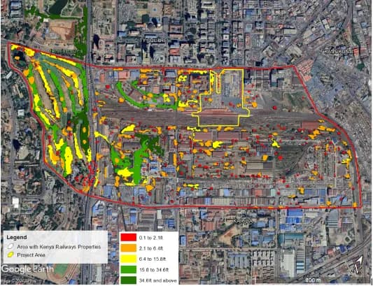
Greening the Rails: A Holistic Carbon Assessment for Kenya Railways Emissions and Sinks
Assessing Greenhouse Gas Emissions and Evaluating their Significance within the proposed Kenya Railways City project area.
Services we use here: Drone, LiDAR & Survey Mapping, Web Maps & Dashboards, Satellite Monitoring & AI.
Explore other sectors we serve: Government & Public Sector, NGOs, Donors & Community Development, Utilities, Agriculture and Irrigation Services, Environmental Monitoring, Natural Resources, Conservation, Climate Change Science and Adaptation, IT and Software Engineering.

Ready to Transform Your Business?
Partner with us for expert guidance and strategies that drive growth and success.
Contact UsGet Your Free Consultation