
Topographic & 3D Mapping
Drone surveys that produce detailed maps, terrain models and building outlines for towns, islands and project sites.
What this means for you
- Up-to-date base maps
- Faster and cheaper than ground surveys
- Ready for engineering and planning
Part of our Infrastructure and Transportation offering.
Related solutions: Urban Planning, Route Optimization, Asset Condition Monitoring.
See it in action
Environment & Climate · Kenya
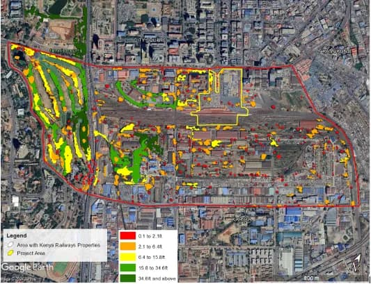
Greening the Rails: A Holistic Carbon Assessment for Kenya Railways Emissions and Sinks
Assessing Greenhouse Gas Emissions and Evaluating their Significance within the proposed Kenya Railways City project area.

Ready to Transform Your Business?
Partner with us for expert guidance and strategies that drive growth and success.
Contact UsGet Your Free Consultation